


RALLY ROADBOOK SYSTEM
PRODUCE RALLY NAVIGATION ROADBOOKS
[ CHOOSE YOUR RALLY FORMAT ]




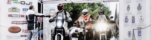
Rally Navigator Streamlines the Process of Creating Rally Navigation Roadbooks Using the Power of Digital Mapping and GPS. Design Your Route, Add Waypoint Details and Produce FIA Specification Rally Roadbook PDF + Matching GPX File for Cross Country and Road & Stage Rally Events. It is a complete roadbook editor and road book maker for desktop, with a companion roadbook reader app for Android and iOS.
CREATE. SHARE. RALLY.


- MapBox 3D Terrain Imagery
- Runs - Saves - Prints PDF on Local Computer
- Share via Dropbox, iCloud, OneDrive
- Adjustable Waypoint & Validation Radius Details Show on Map
- On Screen Roadbook Auto Highlighting
- FIA/Dakar Navigation Icons in SVG

RALLY NAVIGATOR INTEGRATES WITH LEADING RALLY TRACKING SYSTEMS






Print PDF Roadbooks & Download Matching GPX File With Complete Stage Data - Loads Directly to Rally Tracking & Scoring System - Reduce Human Error & Save Time

Frequently Asked Questions
What Is a Rally Roadbook?
A rally roadbook is a turn-by-turn navigation document that a rally crew follows during an event. Each waypoint shows the distance to the next instruction, a tulip diagram of the junction, a compass heading, and icons or notes warning of hazards and landmarks.
What Is Rally Navigator?
Rally Navigator is desktop software for creating professional, FIA-compliant rally roadbooks. You design your route on a map, and it captures distances and headings, draws tulip diagrams, and prints a finished roadbook to PDF or exports an OpenRally GPX file.
Is Rally Navigator Free?
Rally Navigator offers a free 7-day trial with all Premium and Pro features, including PDF and GPX export. Free-tier roadbooks are limited to 25 km or 25 waypoints; Premium and Pro subscriptions remove the limit.
Does Rally Navigator Create FIA-Compliant Roadbooks?
Yes. Rally Navigator lays out print-ready roadbook pages that meet FIA and FIM roadbook specifications, with the full library of FIA and Dakar navigation icons.
What Roadbook Formats Can I Export?
You can print roadbooks to PDF in A4, A5, Letter, Legal, and continuous moto-roll formats, and export an OpenRally GPX file with scoring and control data for your timing system.
What Platforms Does Rally Navigator Run On?
Rally Navigator runs on Windows, macOS, and Linux. Roadbooks can also be viewed on the Rally Roadbook Reader mobile app for iOS and Android.


© 2012–2026 Rally Navigator, LLC